Our Recent Projects
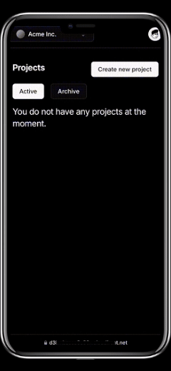
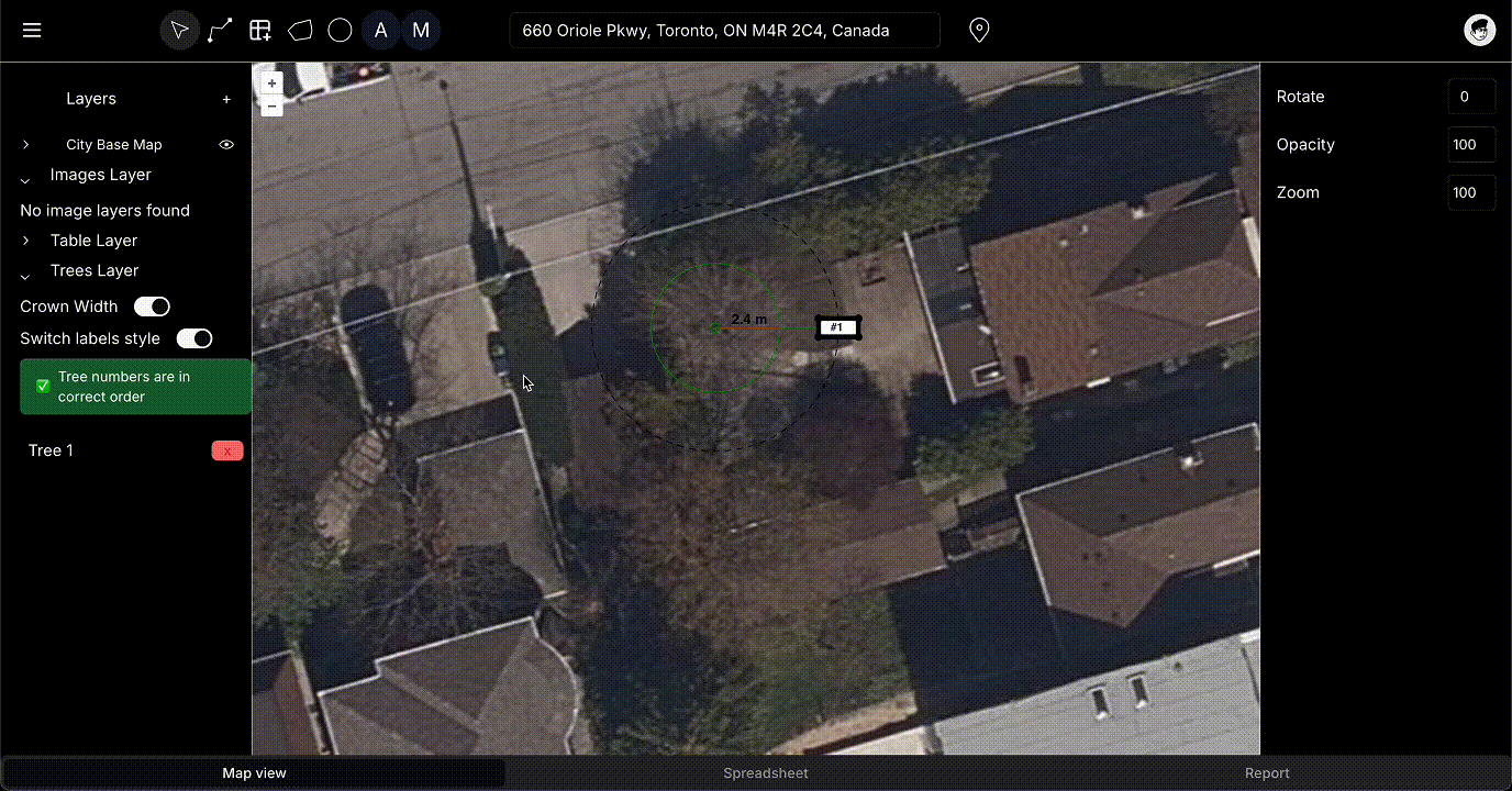
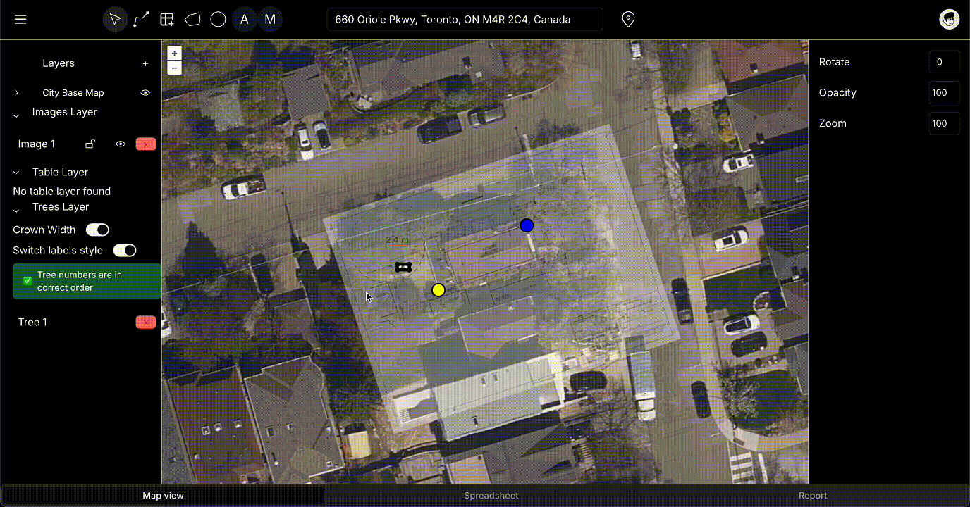
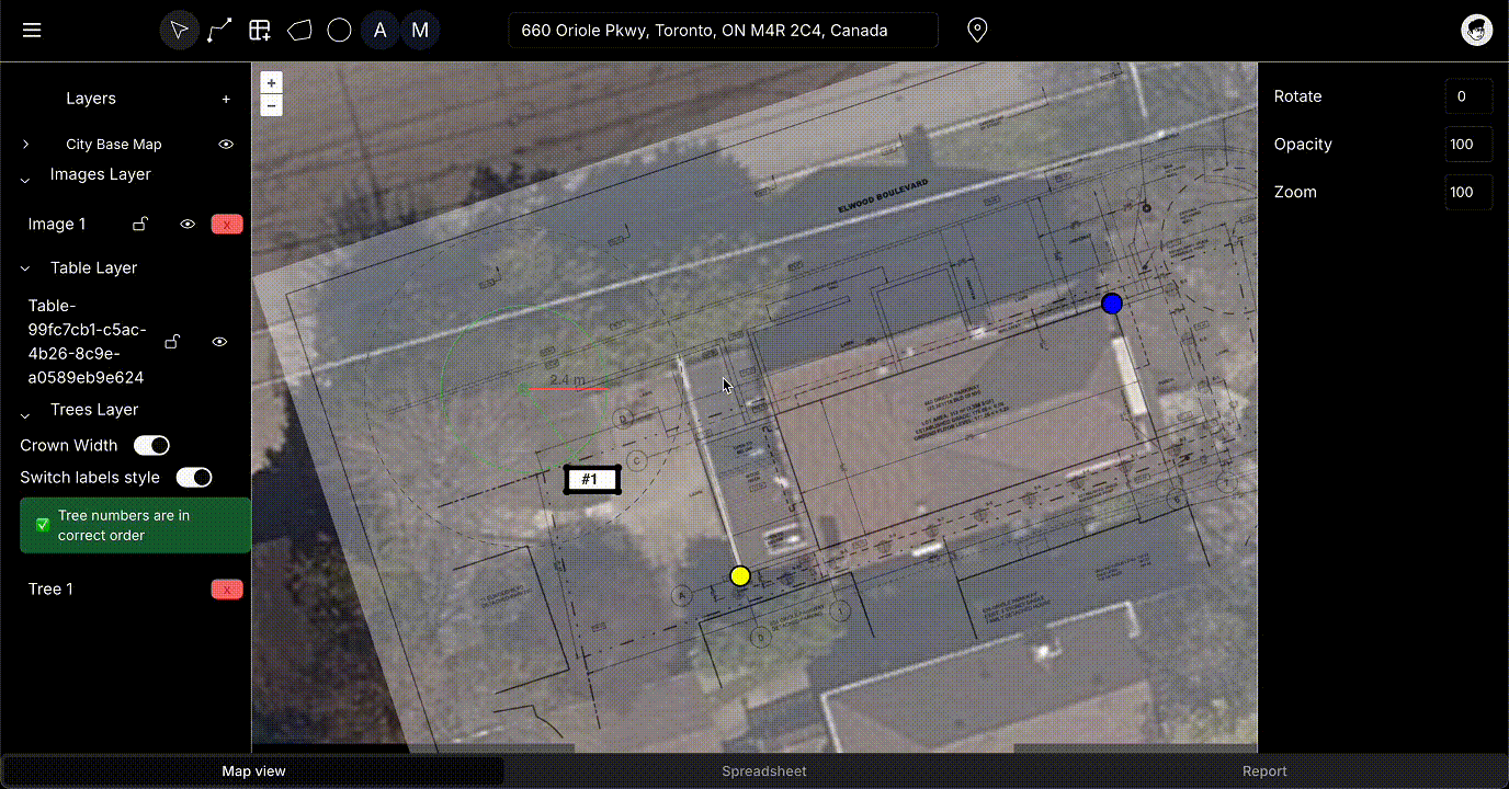

Arborist Application
A GIS tool for efficient tree inspection and management in urban environments.
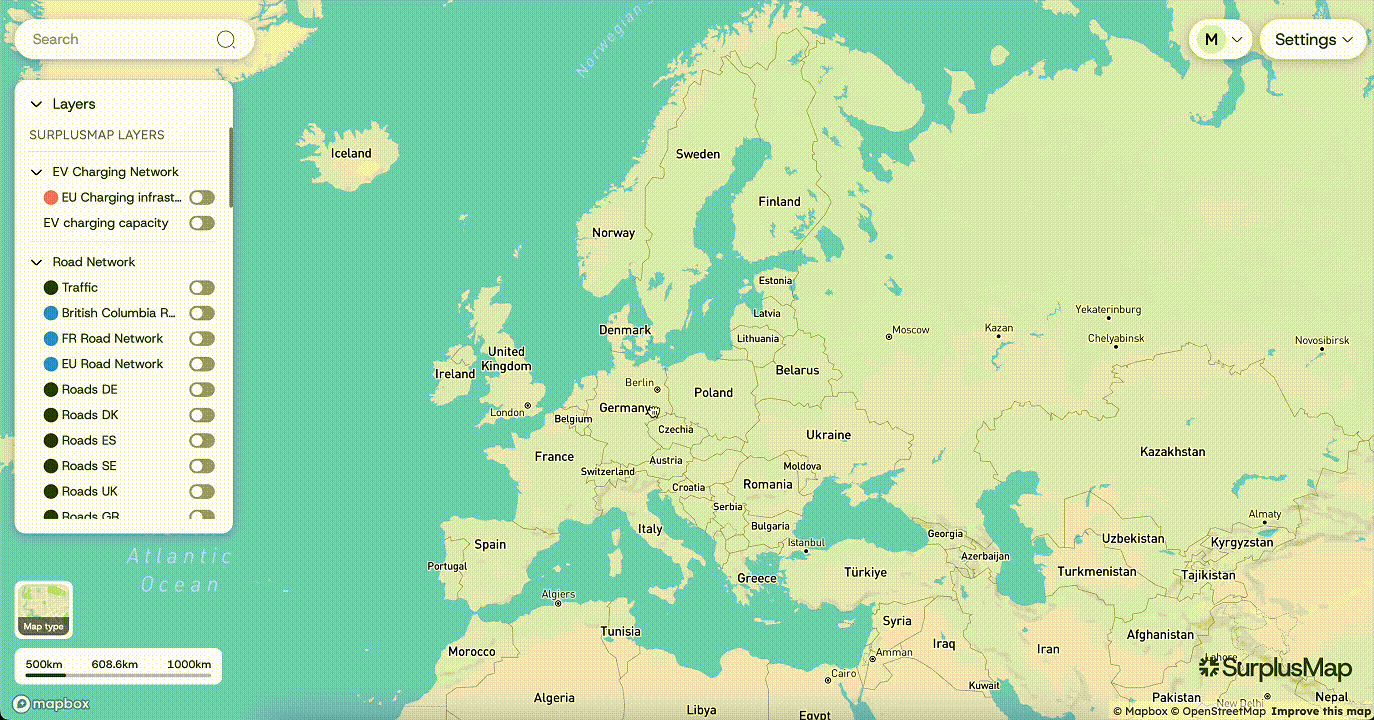
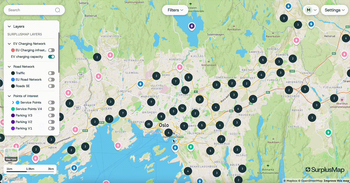
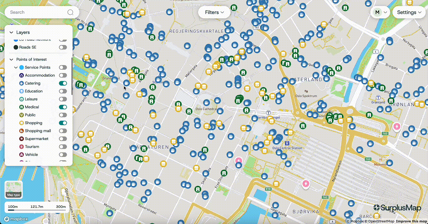
SurplusMap
A powerful spatial analytics platform for informed decision-making using geographic data insights.

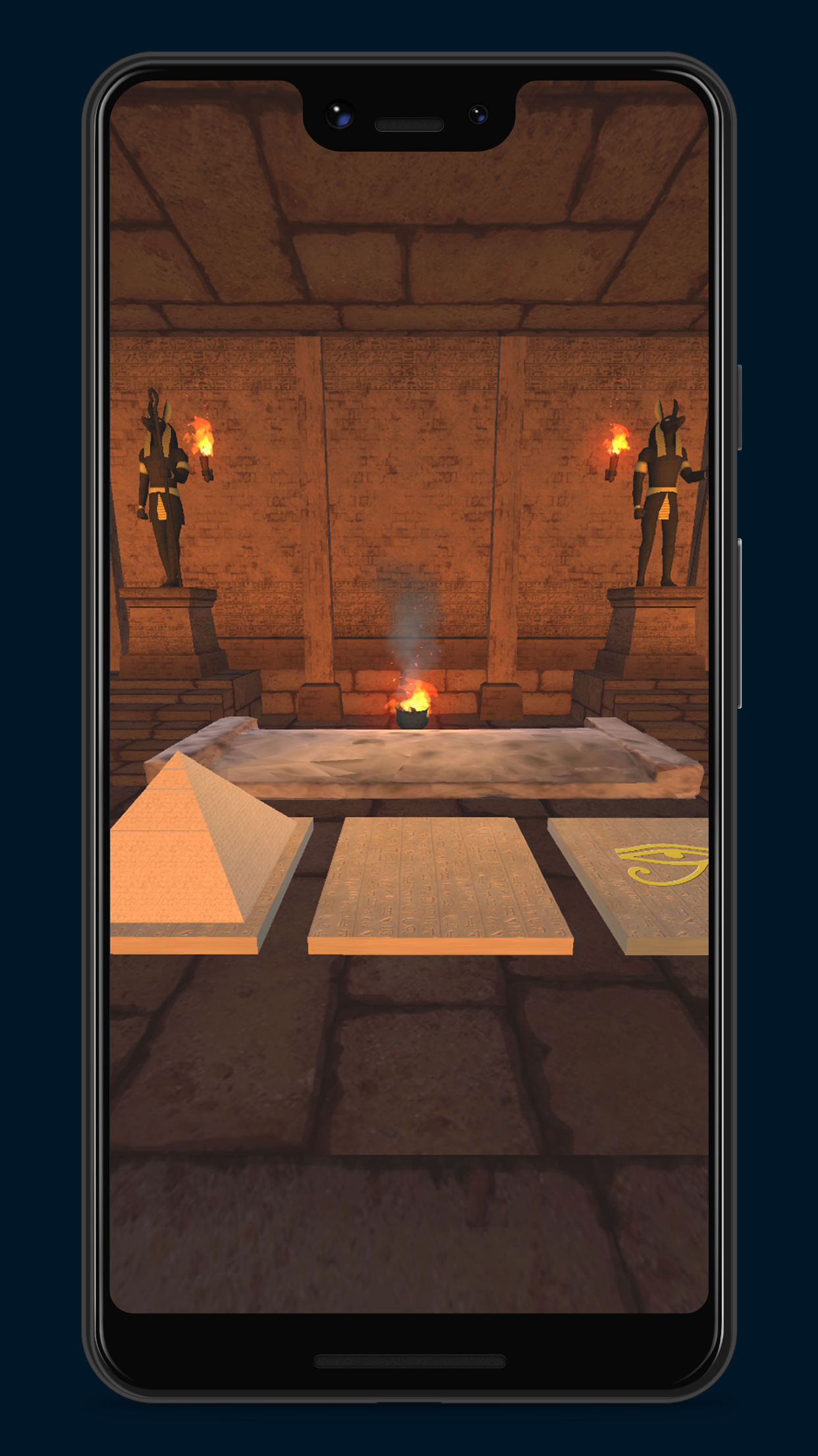

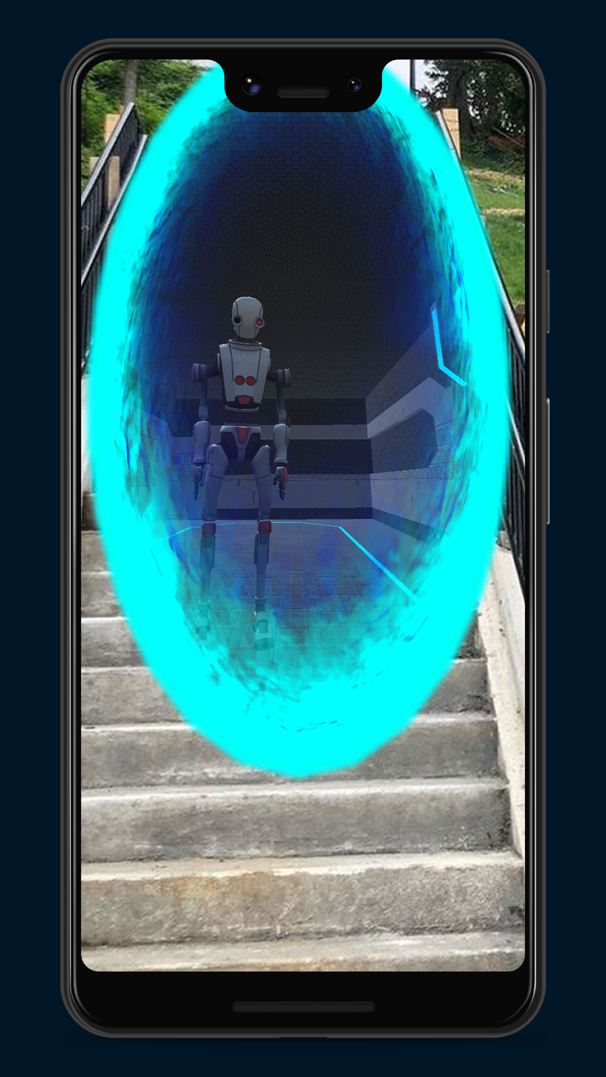

The Time Traveller
An Augmented Reality Escape Room adventure that brings puzzle-solving to your city.
What our clients say
Report Generator Application for Urban Forestry- GIS Developer (Python/QGIS/Web Development)
Jun 13, 2024 - Aug 29, 2024
"Almas is a great developer and communicator, two things rarely found together in the same person. He has been transparent in the development process from start to finish and always overdelivers. Highly recommend."
FAQs
What services do you offer?
We specialize in GIS design and development services. Our expertise includes UI/UX design, data visualization, frontend and backend development. We focus on creating scalable and user-friendly solutions tailored to your needs.
How long is the process?
The timeline varies based on project complexity and requirements. Typically, we provide an estimated timeline during the initial consultation. Our goal is to deliver quality solutions efficiently.
Do you offer support?
Yes, we provide ongoing support for all our projects. This includes troubleshooting, updates, and enhancements as needed. Our team is dedicated to ensuring your application runs smoothly.
Can you handle custom requests?
Absolutely! We thrive on custom projects that challenge our creativity and expertise. Share your vision with us, and we will work collaboratively to bring it to life.
What technologies do you use?
We use desktop applications, such as QGIS and AutoCAD. On the frontend we utilize OpenLayers and Mapbox. On the the backend we utilize Python (Geopandas, FastAPI, etc.), PostgreSQL/PostGIS, GDAL, and more. We have also extensive experience with Google Cloud Platform, in particular Google BigQuery, Cloud Run, Dataform/dbt, Vertex AI, Looker Studio, and more.