SurplusMap
A powerful spatial analytics platform for informed decision-making using geographic data insights.
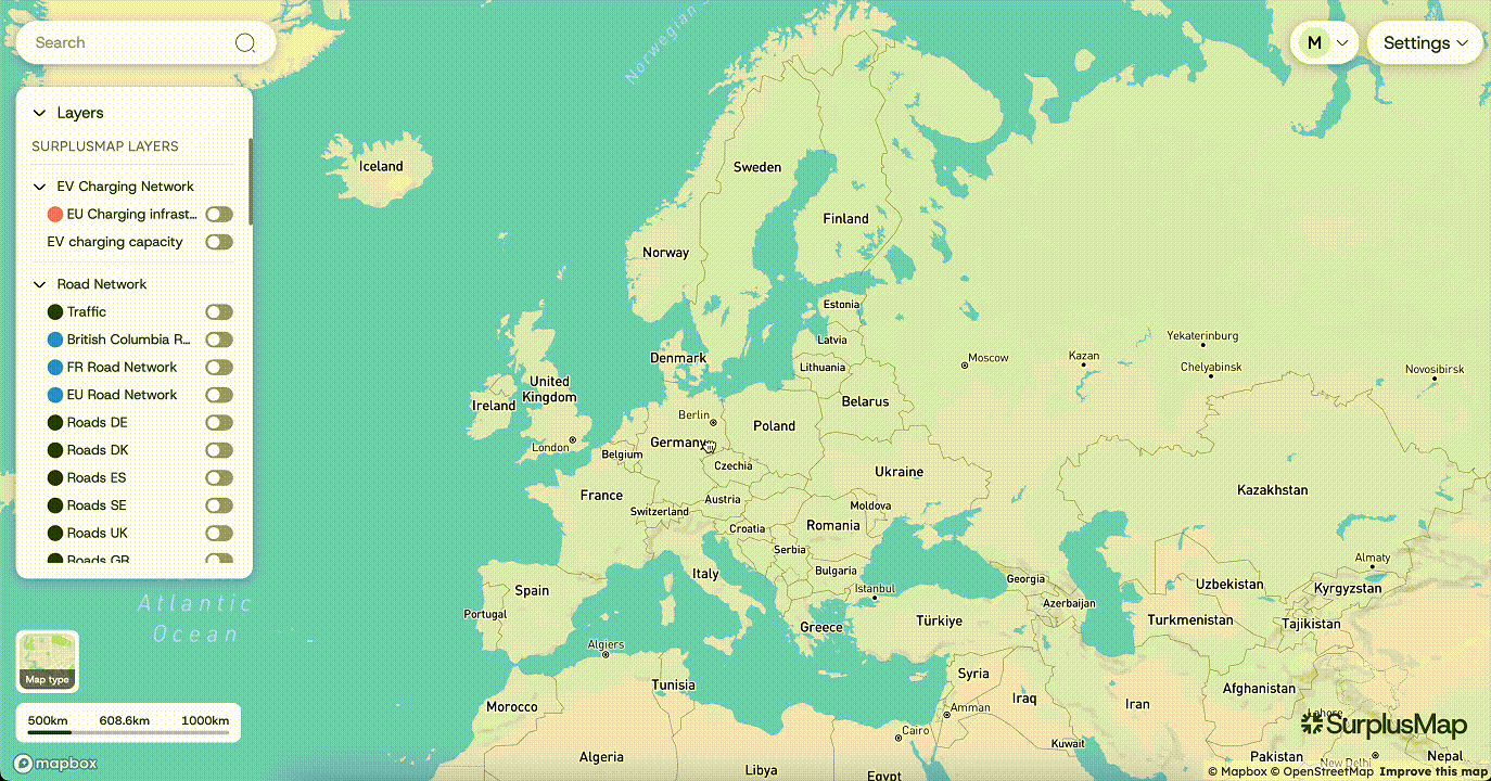
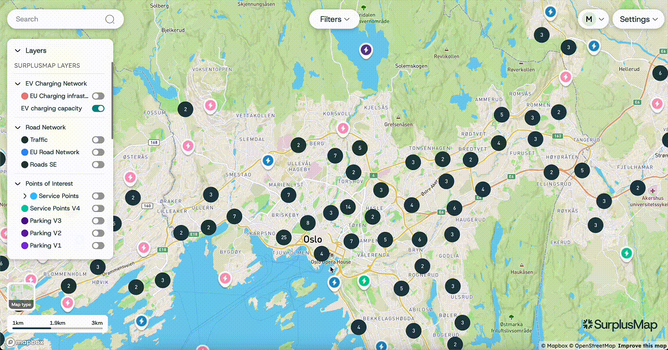
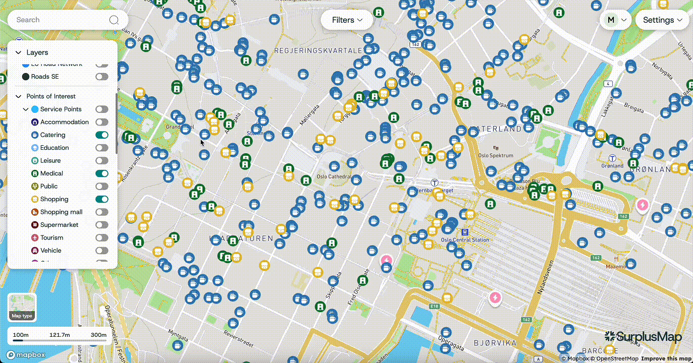
SurplusMap is a cutting-edge spatial analytics platform designed to empower organizations with data-driven decision-making capabilities. By leveraging advanced GIS technologies, it transforms complex geographic data into actionable insights, enabling users to visualize trends and patterns effectively.
Built using modern web mapping technologies, SurplusMap integrates seamlessly with tools like OpenLayers and Mapbox, providing a robust and interactive user experience. Its intuitive interface allows users to easily navigate through data layers, customize views, and generate meaningful reports that support strategic planning.
Key Features
- Real-time data processing and visualization
- Integration with OpenLayers and Mapbox
- Collaborative tools for team communication
- Customizable data layers and views
- Advanced reporting and analytics
- Scalable architecture for enterprise use
Real-time Data Processing
One of the standout features of SurplusMap is its real-time data processing, which ensures that users have access to the most current information available. This feature is particularly beneficial for industries such as urban planning, environmental monitoring, and resource management, where timely data is crucial for operational success.
Collaborative Features
In addition to its powerful analytics capabilities, SurplusMap offers collaborative tools that facilitate teamwork and communication among stakeholders. Users can share insights, annotate maps, and discuss findings within the platform, fostering a collaborative environment that enhances project outcomes.
Use Cases
Urban Planning
Analyze city development patterns and optimize infrastructure planning with comprehensive spatial data visualization.
Environmental Monitoring
Track environmental changes and assess impact on ecosystems using real-time monitoring capabilities.
Resource Management
Optimize resource allocation and distribution strategies through advanced geographic analytics.
Business Intelligence
Transform geographic data into actionable business insights for strategic decision-making.
Technical Implementation
SurplusMap is built with modern web technologies and follows industry best practices:
- Frontend: Modern JavaScript frameworks with OpenLayers and Mapbox integration
- Backend: Robust data processing and storage systems
- Real-time Processing: Live data feeds and instant visualization updates
- Scalability: Enterprise-ready architecture supporting large datasets
Results
With SurplusMap, organizations can unlock the full potential of their geographic data, leading to improved efficiency, better resource allocation, and informed decision-making. Experience the future of spatial analytics with SurplusMap and take your data-driven strategies to the next level.